How Satellites Save Lives During Natural Disasters Within Hours
When disaster strikes, emergency response often hinges on action taken hundreds of miles above Earth. Before rescue teams even launch, commanders trigger a global request for satellite imagery through mechanisms like the International Charter "Space and Major Disasters." Operating silently in the background, this voluntary coalition mobilizes multi-billion-dollar space assets to deliver free, high-resolution orbital data to first responders within hours. Here is how space technology transforms raw imagery into life-saving rescue plans.

What is the International Charter "Space and Major Disasters"?
Founded in October 2000 by the European Space Agency (ESA), France's CNES, and the Canadian Space Agency (CSA), the International Charter operates on a straightforward principle: share satellite data freely and immediately during major disasters.
Over the past quarter-century, this initiative has expanded into a global powerhouse:
- 17 Member Space Agencies: Uniting major space powers including NASA/NOAA (USA), JAXA (Japan), ISRO (India), CNSA (China), and Roscosmos (Russia).
- 270+ Orbital Assets: A vast network combining optical, thermal, and radar sensors.
- 1,000+ Activations: Providing coverage across more than 140 countries.
- Universal Access Program: Expanding eligibility beyond founding members so developing nations can request emergency imagery directly.
Geopolitics often stall international diplomacy, but the Charter operates on a strict humanitarian protocol delivering life-saving orbital intelligence regardless of political friction on the ground.
The International Charter: Space and Major Disasters
How an Emergency Activation Works in Real Time
When a crisis unfolds, every minute counts. The Charter's activation architecture is built for extreme speed:
Triggering the Request: Authorized Users initiate the protocol.
A designated disaster manager or agency triggers the Charter directly through an authorized portal as soon as a major event strikes.
On-Call Officer (OCO) Assignment: Rapid tasking within minutes.
An On-Call Duty Officer analyzes the disaster zone, evaluates atmospheric conditions, and tasks the optimal satellites passing overhead.
Orbital Capture & Processing: Targeting under 2 hours.
Satellites capture high-resolution radar and optical data over the impact zone and downlink it to ground stations.
Value-Added Mapping: Converting raw data to GIS layers.
Engineers convert raw imagery into actionable vector maps showing flooded zones, destroyed infrastructure, and clear evacuation corridors.
During high-intensity response windows, up to 90% of first crisis images are delivered within two hours of activation, supplying rescue teams with near-real-time situation reports.
The Secret Weapon Synthetic Aperture Radar (SAR)
Optical satellite photographs are ideal for clear days, but severe storms and floods are accompanied by dense cloud cover and torrential rain. Daylight is also limited during winter or overnight disasters.
This is where Synthetic Aperture Radar (SAR) becomes indispensable.
Unlike optical cameras that rely on reflected sunlight, SAR satellites emit active radar signals that penetrate heavy clouds, smoke, and storm systems. Because SAR measures the texture and dielectric properties of the surface, standing water appears as a smooth, dark surface, making SAR the gold standard for 24/7 flood mapping and hurricane impact assessment.
| Capability | Optical Satellites | SAR (Radar) Satellites |
|---|---|---|
| Daylight Requirement | Requires Sunlit Conditions | Works in Total Darkness |
| Cloud Penetration | Blocked by Heavy Clouds/Smoke | 100% Cloud Penetration |
| Best Used For | Fire Damage, Structural Ruptures | Flood Delimitation, Storm Surges |
| Primary Data Output | True-Color Photography | Backscatter Radar Mapping |
Field Impact Mapping the Horn of Africa Flood Crises
The real-world impact of orbital intelligence is best seen during complex, multi-variable emergencies.
In late 2023, severe flooding hit Somalia and the broader Horn of Africa, driven by an intense El Niño phase combined with a positive Indian Ocean Dipole. Tens of thousands of square kilometers were inundated, washing out roads and cutting off entire communities.
By tapping into Charter-coordinated SAR data:
- Infrastructure Analysis: Emergency coordinators mapped severed bridges along the Jubba and Shabelle rivers.
- Resource Deployment: Humanitarian groups targeted airlifts precisely to isolated island pockets created by rising waters.
- Risk Prediction: Hydrologists tracked flood crests moving downstream in real time, giving communities hours to evacuate before water arrived.
The Evolving Landscape Commercial Fleets & Cloud Infrastructure
While the International Charter remains the primary government framework, the Earth Observation (EO) ecosystem has shifted rapidly:
- Commercial Constellations: Providers like Planet, Maxar, and Capella Space deploy micro-satellite constellations that revisit target zones multiple times per day, offering sub-meter optical and radar resolution.
- Third-Party Data Contributors: The Charter routinely integrates commercial data streams alongside national assets to increase re-visit frequencies.
- Cloud Processing at Scale: Modern analytics pipelines run on high-performance cloud architectures such as the Copernicus Data Space Ecosystem processing raw telemetry into thematic GIS maps in minutes rather than hours.
Streamlining Actionable Access The Role of OnGeo Intelligence
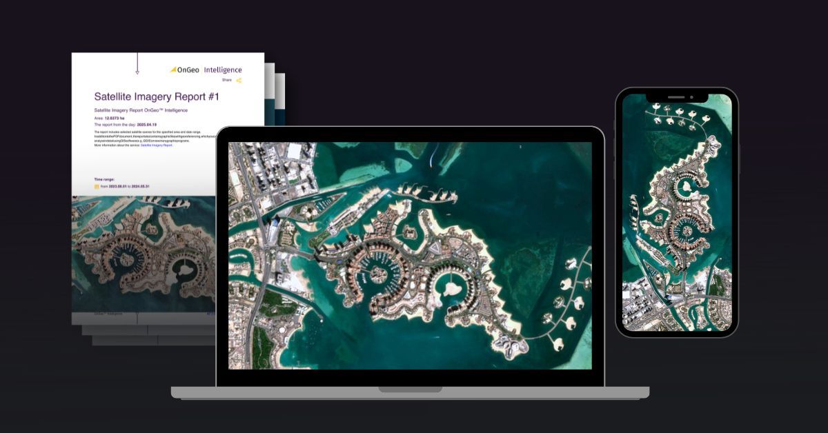
A major bottleneck in disaster management has traditionally been the complexity of acquiring, filtering, and processing satellite feeds under extreme time constraints. OnGeo Intelligence addresses this by bridging advanced Earth observation archives with an intuitive, on-demand report delivery model:
Rapid Report Generation OnGeo Intelligence allows analysts, local authorities, and insurers to select specific target areas and generate location-based satellite reports delivering low-resolution and high resolution datasets shortly after.
Multi-Constellation Aggregatio Instead of forcing users to navigate disparate agency platforms, OnGeo aggregates data across commercial and open constellations in the form of a clear PDF report. No need to create an account or pay for a subscription.
Download a Sample Satellite Imagery Report
Find out more about the Satellite Imagery Report
Real-World Case Studies from OnGeo Intelligence Analysis
Spatial intelligence and remote sensing platforms like OnGeo Intelligence analyze high-impact Earth observation data during critical environmental events. Examining specific disaster footprints highlights how satellite telemetry turns into operational clarity:
High-Altitude Glacial Flash Floods (Nepal–Tibet Border)
When a remote glacial lake outburst triggered a devastating flash flood along the Nepal–Tibet border, ground-based access was virtually impossible due to the rugged terrain.
The Orbital Solution: Multi-temporal optical satellite imagery enabled analysts to trace the exact origin of the glacial collapse upstream.
Wildfire Hotspot & Scar Mapping (Omiš, Croatia)
During severe Mediterranean heatwaves, wildfire clusters spread across Croatia’s Split-Dalmatia County, threatening populated coastal towns like Omiš.
The Orbital Solution: Thermal anomalies detected via satellite platforms identified approximately 200 active hotspots across dense terrain.
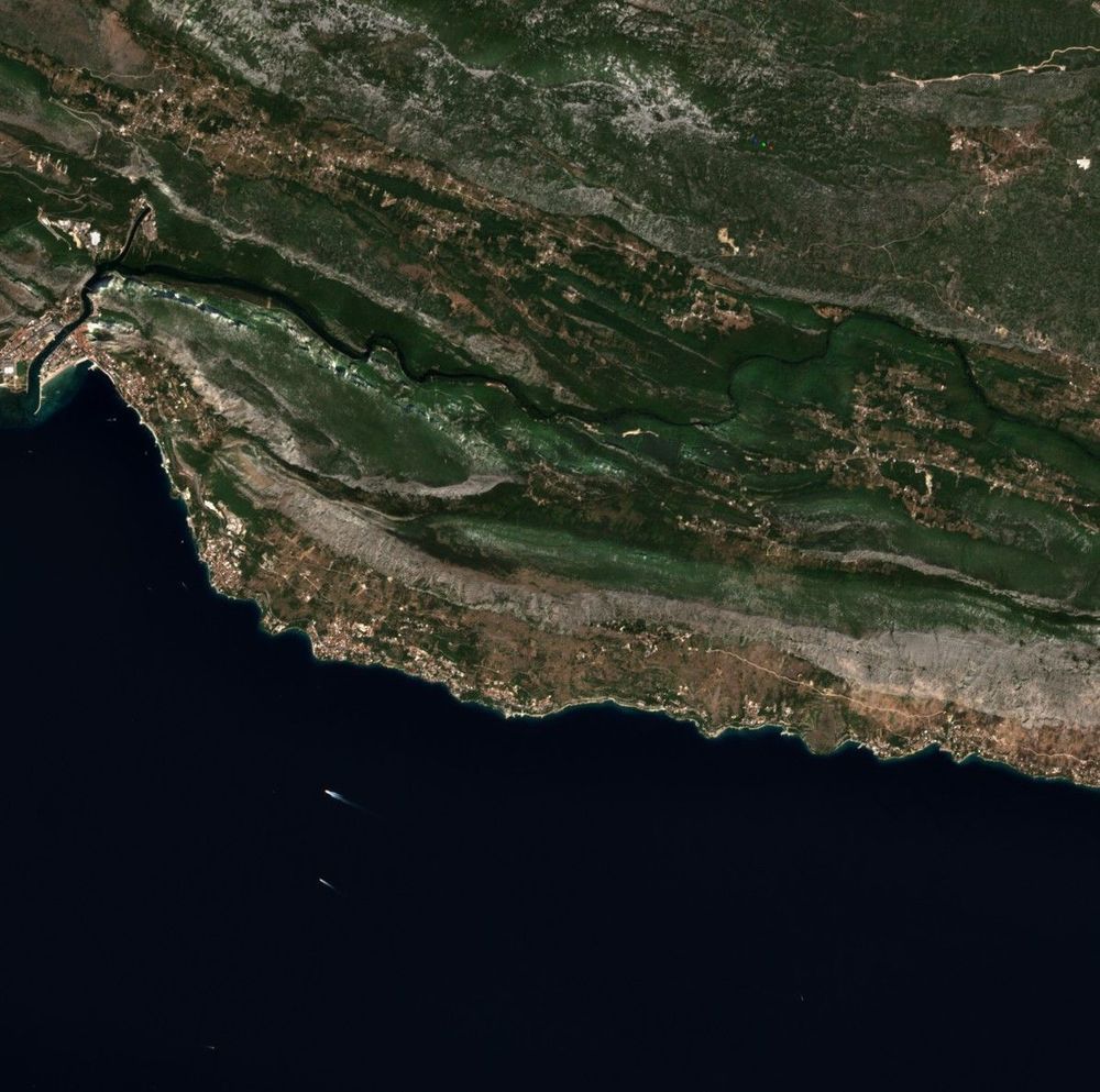
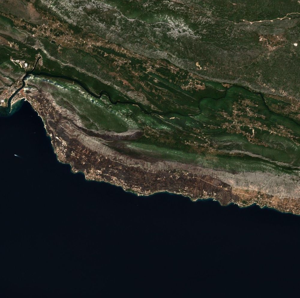
Before and after the fire Devastates Omiš Area
Frequently Asked Questions (FAQ)
Who can activate the International Charter during a disaster?
Activation is restricted to Authorized Users typically national disaster management authorities, civil protection agencies, and accredited international humanitarian organizations under the Charter’s Universal Access initiative.
Is there any cost associated with requesting Charter data?
No. The International Charter operates strictly on a voluntary, no-funds-exchanged basis. All satellite tasking, data processing, and distribution are provided completely free of charge to receiving disaster response units.
Why can't optical satellites handle all disaster monitoring?
Major disasters like typhoons, hurricanes, and heavy rainfall events create thick cloud cover that completely blocks optical cameras. Radar satellites (SAR) bypass this limitation by bouncing radio waves off Earth's surface through clouds, rain, and darkness.
How quickly can first responders expect usable map data?
In most modern activations, initial satellite acquisitions and processed disaster extent maps reach ground commanders within 2 to 4 hours of the initial request.
Related articles
- How Satellites Monitor Climate Change
- Why Metadata Is Essential in Satellite Earth Observation
- How Satellite Imagery Improves Crisis Management and Disaster Response
- How to Acquire Free Satellite Imagery for Your Investigations
- How Often Do satelites Take Pictures? Satellite Imagery Frequency
- From Space to Shore: How Earth Observation Satellites Help Monitor Water Quality